一、个人简介
刘瑞(1979-),汉族,山西沁县人,中共党员,博士,副教授,硕士生导师。中国石油四川石油管理局、西南油气田分公司工学博士后,成都理工大学理学博士后,加拿大滑铁卢大学访问学者,四川省海外高层次留学人才。现任职于成都理工大学地球物理学院空间科学系,地球勘探与信息技术重点实验室固定研究人员。主要从事基于3S技术的地学分析与应用,地质灾害数值模拟分析与评估,地学空间信息数据挖掘与分析等领域的教学与科研工作。近5年来,作为主持4项省部级科研项目,作为科研骨干参与10余项国家级科研项目。以第一作者或通信作者发表学术论文10余篇,其中SCI检索4篇,EI检索8篇,CPCI-S检索4篇,中文核3篇,申请国家发明专利4项,获得软件著作权8项。目前是《Geocarto International》、《Earth Science Informatics》、《IEEE Access》、《Remote Sensing》、《Arabian Journal of Geosciences》、《Environmental Earth Sciences》、《航天返回与遥感》、《沉积与特提斯地质》、《武汉大学学报(信息科学版)》、《兰州交通大学学报》、《西华师范大学学报(自然科学版)》等学术期刊审稿人,CPGIS协会会员,ASPRS协会会员,中国遥感应用协会会员。
二、教育经历
(1) 2006-09 至 2009-06, 成都理工大学, 地球探测与信息技术, 博士
(2) 2002-09 至 2005-06, 成都理工大学, 电子与通信工程, 硕士
(3) 1997-09 至 2002-06, 成都理工大学, 计算机科学与技术, 学士
三、工作经历
(1) 2013-12 至今, 成都理工大学, 地球物理学院, 副教授
(2) 2015-12 至 2017-01, 加拿大Waterloo大学, 访问学者
(3) 2010-03至2012-10, 中国石油四川石油管理局、西南油气田公司博士
后科研工作站, 博士后
四、教学情况
主讲课程:《地学数据挖掘与融合》、《对地观测信息处理》、《遥感原理与技术》、《智慧城市与大数据》、《互联网技术》、《数据库技术》、《制图软件综合应用》。
个人荣誉:成都理工大学优秀研究生导师名单,成都理工大学优秀班主任。
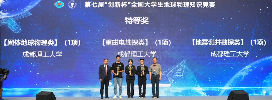
指导学生所得荣誉:“2013Esri杯中国大学生GIS软件开发竞赛”一等奖,“2012年第四届全国高校GIS技能大赛”优秀奖,“四川省第十二届“挑战杯”大学生科技竞赛”二等奖,“四川省第十四届“挑战杯”大学生科技竞赛”二等奖,“2018Esri杯中国大学生GIS软件开发竞赛”优秀奖,2019年“成都理工大学大学生课外科技竞赛”一等奖等好成绩。
五、科研情况
★主持及参与科研项目情况:
(1)公园城市背景下成都公园承载力体系构建与评估
(2)新疆轮台县、和静县地质灾害重要区域精细化调查及数据库建设
(3)青神县地质灾害风险调查评价项目
(5)成都理工大学2021年度中青年骨干教师培养计划
(6)四川省峨边彝族自治县地质灾害风险调查评价子题
(7)乌蒙山连片贫困区1:5万地质灾害调查
(9)四川省阆中市、凉山彝族自治州甘洛县地质灾害遥感调查
★发表学术论文情况:
(1) Rui Liu, Xin Pan, Zuhua Xia, et al. How to lead the optimization of parks spatial patterns more comprehensively with the philosophy of green equity: A case of Chengdu[J]. Habitat International, 2025, 157: 103318. (10.1016/j.habitatint.2025.103318)
(2) Rui Liu, Juncheng Gou, Jialiang Han. et al. Optimizing groundwater potential assessment: uncertainty reduction through sample balancing and enhanced hybrid modeling. STOCHASTIC ENVIRONMENTAL RESEARCH AND RISK ASSESSMENT (2025). (10.1007/s00477-025-02941-1)
(3) Rui Liu, Jialiang Han, Juncheng Gou, et al. Indispensable factors in landslide susceptibility modeling: the critical role of slope unit quantity-sensitivity[J]. Earth Science Informatics, 2025, 18(2): 248. (10.1007/s12145-025-01766-4)
(4) 雷雨竺,刘瑞,曹礼刚,冯希尧. 基于变化检测的北川羌族自治县震后重建监测与动态分析[J]. 物探化探计算技术. 2024.
(5) Guolei He, Rui Liu, Jingsong Gou, Ao Zhang. Water body recognition method based on improved encoder-decoder structure[C]. Proc. SPIE 13213, International Conference on Image Processing and Artificial Intelligence (ICIPAl 2024). (10.1117/12.3035329)
(6) Gou Jinsong, Rui Liu, Guolei He, Lei Wu. Surface Deformation Monitoring and Prediction in the Baihetan Hydropower Station Area Based on Small Baseline Subset Interferometric Synthetic Aperture Radar and Grid Search Support Vector Machine[C]. 5th International Conference on Geology, Mapping and Remote Sensing, Wuhan, China, 2024, pp. 230-234. (10.1109/ICGMRS62107.2024.10581182)
(7) 冯希尧,苟俊程,刘瑞,李谷琳,韩佳良,魏良帅等. 基于遗传算法优化机器学习模型的地下水潜在性预测. 科学技术与工程.2024,24 (19):7988-7998.
(8) 雷雨竺,刘瑞,曹礼刚,冯希尧. 基于变化检测的北川羌族自治县震后重建监测与动态分析[J]. 物探化探计算技术. 2024.
(9) 刘瑞,曹凯,田荣刚. 以融合思政建设为导向的遥感原理与技术课程教学探索. 高教学刊 . 2024 ,10 (15):185-188
(10) Rui Liu, Ao Zhang, Fenghua Huang, Guolei He, Jingsong Gou, Yuzhu Lei, Lei Wu. High-resolution building extraction based on the edge-aware network CEEAU_Net[J]. Measurement Science and Technology, 2024, 35(4): 045124. (10.1088/1361-6501/ad214f)
(11) Lei Wu, Rui Liu*, Nengpan Ju, Ao Zhang, Jingsong Gou, Guolei He, Yuzhu Lei. Landslide mapping based on a hybrid CNN-transformer network and deep transfer learning using remote sensing images with topographic and spectral features[J]. International Journal of Applied Earth Observation and Geoinformation, 2024, 126: 103612. (10.1016/j.jag.2023.103612)
(12) 苟晓娟, 刘瑞, 李谷琳, 苟俊程. 中国西南山地城市生态环境质量长时序变化及其评价——以重庆市为例[J]. 物探化探计算技术. 2024 ,46 (02): 224-234
(13) 刘瑞,罗书斌,徐源,李谷琳,苟晓娟. 基于地理信息系统与斜坡单元的峨边彝族自治县地质灾害易发性评价[J]. 科学技术与工程. 2023,23(18), P7678-7685
(14) 薛常兵,徐源,刘瑞,夏祖华. 成都6个市属城市公园的可达性分析[J]. 绿色科技,2023(01):9-13.
(15) Yuan Xu, Rui Liu*, Changbing Xue, Zuhua Xia. Ecological Sensitivity Evaluation and Explanatory Power Analysis of the Giant Panda National Park in China[J]. Ecological Indicators, 2023, 146(109792) (10.1016/j.ecolind.2022.109792)
(16) Rui Liu, Yuan Xu, Changbing Xue, Zuhua Xia, Gulin Li, Xiaojuan Gou, Shubin Luo. Simulation of Early Warning Indicators of Urban Expansion Derived from Machine Learning[J]. Journal of Urban Planning and Development, 2023, 149(1), P1-15. (10.1061/JUPDDM.UPENG-4127)
(17)杨梅,刘瑞*,苟晓娟等. 成渝地区双城经济圈高温热浪时空分析及风险评估[J]. 物探化探计算技术. 2022,44(03):392-404.
(18) Lei Wu, Rui Liu*, Gulin Li, Jingsong Gou, Yuzhu Lei. Landslide Detection Methods Based on Deep Learning in Remote Sensing Images[C]. 29th International Conference on Geoinformatics. (10.1109/Geoinformatics57846.2022.9963885)
(19) Rui Liu, Gulin Li*, Liangshuai Wei, Yuan Xu, Xiaojuan Gou, Shubin Luo, Xin Yang. Spatial prediction of groundwater potentiality using machine learning methods with Grey Wolf and Sparrow Search Algorithms[J]. Journal of Hydrology: 610(2022) 127977. (10.1016/j.jhydrol.2022.127977)
(20) 颜科,刘瑞,杨远陶. 基于RSEI的大熊猫国家公园生态环境评价[J]. 地理空间信息. 2022,20(04):26-30+73.
(21) Jingjue Chen, Rui Liu*, Mei Yang, Xin Yang, Yuantao Yang, Tianqiang Liu. Comparison of SAR Image Water Extraction Algorithms Based on Grey Incidence Analysis[C]. Lecture Notes in Electrical Engineering, v813, p477-488, 2022.
(22) 陈景珏,刘瑞*,杨鑫等. 改进Otsu与形态学相结合的水体信息提取[J]. 遥感信息. 2022,37(01):101-109.
(23) 刘瑞,徐源*,叶川炜等. 华东地区多年平均TRMM月降水数据空间降尺度研究[J]. 地理与地理信息科学. 2022,38(02):33-39.
(24) Rui Liu, Xin Yang*, Chong Xu, Liangshuai Wei, Xiangqiang Zeng. Comparative Study of Convolutional Neural Network and Conventional Machine Learning Methods for Landslide Susceptibility Mapping. Remote Sensing(2022). (10.3390/rs14020321)
(25) Xin Yang, Rui Liu*, Mei Yang, Jingjue Chen, Tianqiang Liu, Yuantao Yang, Wei Chen and Yuting Wang. Incorporating Landslide Spatial Information and Correlated Features among Conditioning Factors for Landslide Susceptibility Mapping. Remote Sensing(2021)13:10. (10.3390/rs13112166)
(26) Rui Liu; Luyao Li; Saied Pirasteh; Zili Lai; Xin Yang; Himan Shahabi ; The performance quality of LR, SVM, and RF for earthquake-induced landslides susceptibility mapping incorporating remote sensing imagery[J]. ARABIAN JOURNAL OF GEOSCIENCES, 2021.02, 14(4)
(27) Xin Yang; Rui Liu; Mei Yang; Jingjue Chen; Tianqiang Liu; Yuantao Yang; Wei Chen; Yuting Wang ; Incorporating Landslide Spatial Information and Correlated Features among Conditioning Factors for Landslide Susceptibility Mapping[J]. Remote. Sens., 2021, 13(11)
(28) 刘瑞; 李露瑶; 杨鑫; 杨远陶; 杨梅; 基于因子强关联分析方法的滑坡易发性评价[J]. 地球与环境, 2020, 12(1)
(29) 曾祥强,刘瑞*,杨鑫. 基于卷积神经网络在手势数字识别中的研究分析[J]. 物联网技术. 2021,11(06):10-13.
(30) 杨远陶,刘瑞*,曹礼刚等. 基于随机森林算法的珠海一号高光谱影像土地利用信息提取[J]. 物探化探计算技术. 2021,43(06):818-824.
(31) 郭颖悦, 刘瑞, 颜科. 遥感技术在土地利用规划中的应用[J]. 科技与创新, 2020, No.149(05):155-156.
(32) 颜科, 刘瑞. 基于游客需求的浣花溪公园智慧化建设[J]. 四川林业科技, 2020, v.41;No.194(03):103-107.
(33) Xin Yang, Rui Liu, Luyao Li, Mei Yang, Yuantao Yang, Landslide susceptibility mapping using machine learning for Wenchuan County, Sichuan province, China[C]. E3S Web of Conferences, v 198, October 26, 2020, 2020 10th Chinese Geosynthetics Conference and International Symposium on Civil Engineering and Geosynthetics, ISCEG 2020.
(34) Liu Rui, Li Luyao, Lai, Zili; Yang Xin, Comparison of three statistical methods for earthquake-induced landslides susceptibility in Lushan region China[C]. Source: E3S Web of Conferences, v 198, October 26, 2020, 2020 10th Chinese Geosynthetics Conference and International Symposium on Civil Engineering and Geosynthetics, ISCEG 2020; ISSN: 25550403, E-ISSN: 22671242
(35) Li, Long; Liu, Rui; Pirasteh, Saied; Chen, Xianhua; He, Long; Li, Jonathan ; A novel genetic algorithm for optimization of conditioning factors in shallow translational landslides and susceptibility mapping[J]. ARABIAN JOURNAL OF GEOSCIENCES, 2017, 10(9)
(36) 郭颖悦, 刘瑞, 魏良帅. 湿地公园土地利用的变化监测——以成都白鹭湾湿地公园为例[J]. 四川林业科技, 2019(2):28-31
(37) Huiwen Li, Rui Liu, Jingchun Xie. Random forests methodology to analysis landslide susceptibility: An example in Lushan earthquake[C]. 2015 23rd International Conference on Geoinformatics, Geoinformatics 2015.
(38) XIE Jing-chun, LIU-Rui, LI Hui-wen, LAI Zi-li. Analysis of landslide hazard area in Ludian earthquake based on Random Forests[C]. 36th International Symposium on Remote Sensing of Environment, 11–15 May 2015, Berlin, Germany. Liu Rui, Zhu Jie. Application of An Improved Canny Algorithms Operator in RS Data[C]. Earth and Environmental Science, v 17, n 1, 2013.
(39) Liu Rui, Zhu Jie, Gou Changjiang, Feng Ce. Research On Detecting Ground Obstructions In Mountain Seismic Line Deployment[C]. 2013 21st International Conference on Geoinformatics, Geoinformatics 2013.
(40) Gou Changjiang, Liu Rui, Feng Ce. GIS-based landslide susceptibility mapping using analytical hierarchy process in Wenchuan[C]. 2013 21st International Conference on Geoinformatics, Geoinformatics 2013.
(41) 冯策,刘瑞,苟长江. 基于Logistic回归模型的芦山震后滑坡易发性评价[J]. 成都理工大学学报(自然科学版). 2013,40(3):282-287.
六、研究生招生意向
1.区域滑坡敏感性分析及关键地物遥感提取
2.地质灾害数值模拟分析与评估
3.地学空间信息数据挖掘与分析
七、联系方式
电话:13628040195
Email: lr@cdut.edu.cn
办公室:成都理工大学北翼楼5814